When most people think of Moab, Utah they think of Canyonlands and Arches National Parks with red rock country mountain bikers love to dream about. Mentioning how beautiful the La Sal Mountains are typically yields a blank look.
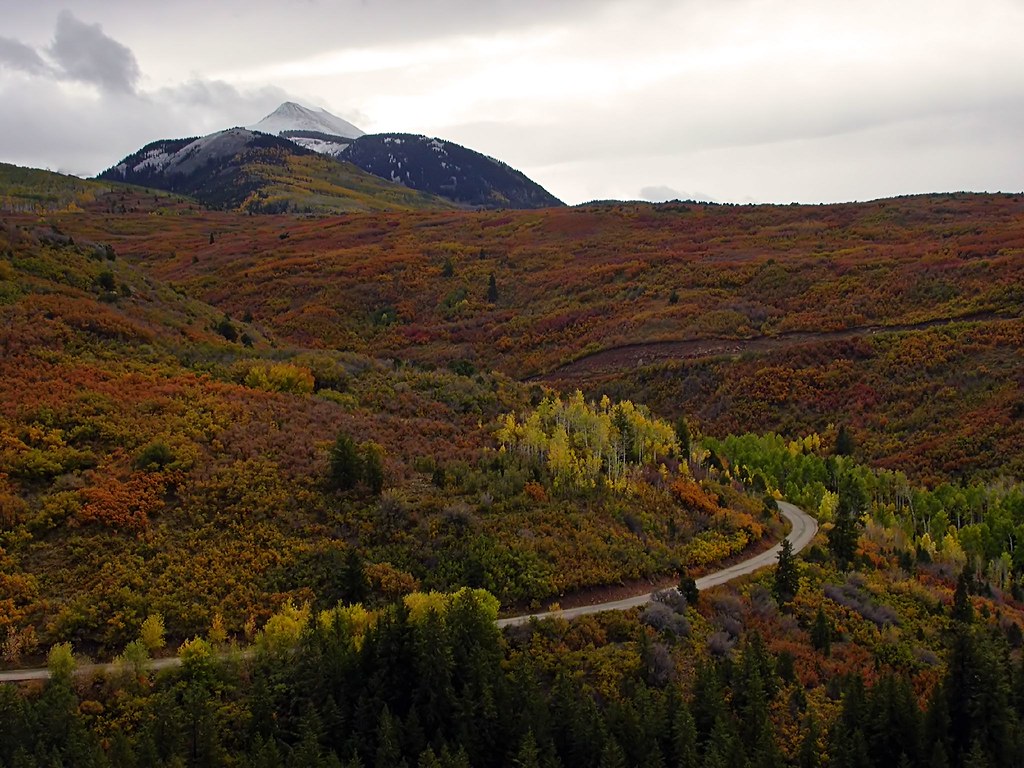
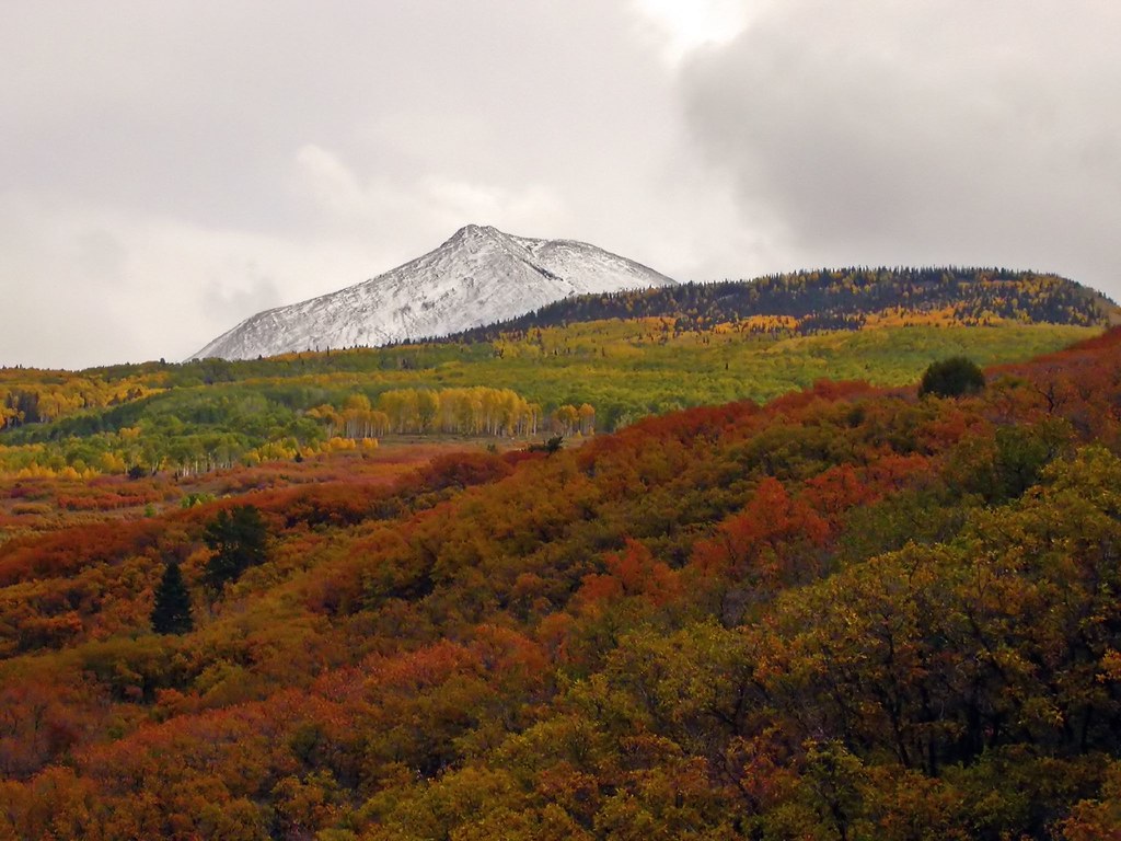
Perhaps this series of photographs might make you consider taking a closer look at these mountains rising just to the east of Moab. The La Sals formed roughly 24 million years ago and include 6 peaks that rise above 12,000 feet, the tallest being Mount Peale at 12,721 feet. The chain is relatively small at only 15 miles north to south and 6 miles across. Native American occupation started as early as 12,000 B.C. Ecology of the area includes massive amounts of quaking aspen and smaller amounts of fir forests, interspersed with alpine meadows. The entire area is a fall photography wonderland.
For a trip to explore the La Sal's on your way home that will ultimately get you back to I-70, take the La Sal Mountain Loop Road that begins on US 191 six miles south of Moab. It winds north over the La Sal mountains through Castle Valley to end at U-128. Here's a view of the of the La Sal Mountains at sunset from Arches National Park:

And here's a series taken along the La Sal Mountain Loop Road:


3 comments:
That first show is awe inspiring. I can't believe you have been hiding all these shots for so long!
Great series Mike. I love the winding road through the hills. Your site has become a pleasant oasis to visit after I take my tour of all things politics. It's nice to see some beautiful things. You have really been able to capture the beauty of the places you visit. Again, I agree with Lee,,,,,,where have you been hiding these shots?
Wow! Ummm - wow. Stunning I mean really. . .The clouds in contrast with the foliage is insane. I really can not look at them long or it seems like they are moving. Wonderful series - flippin' amazing. Dang!
Post a Comment