Wednesday, May 31, 2006

Memorial Day Weekend Fun

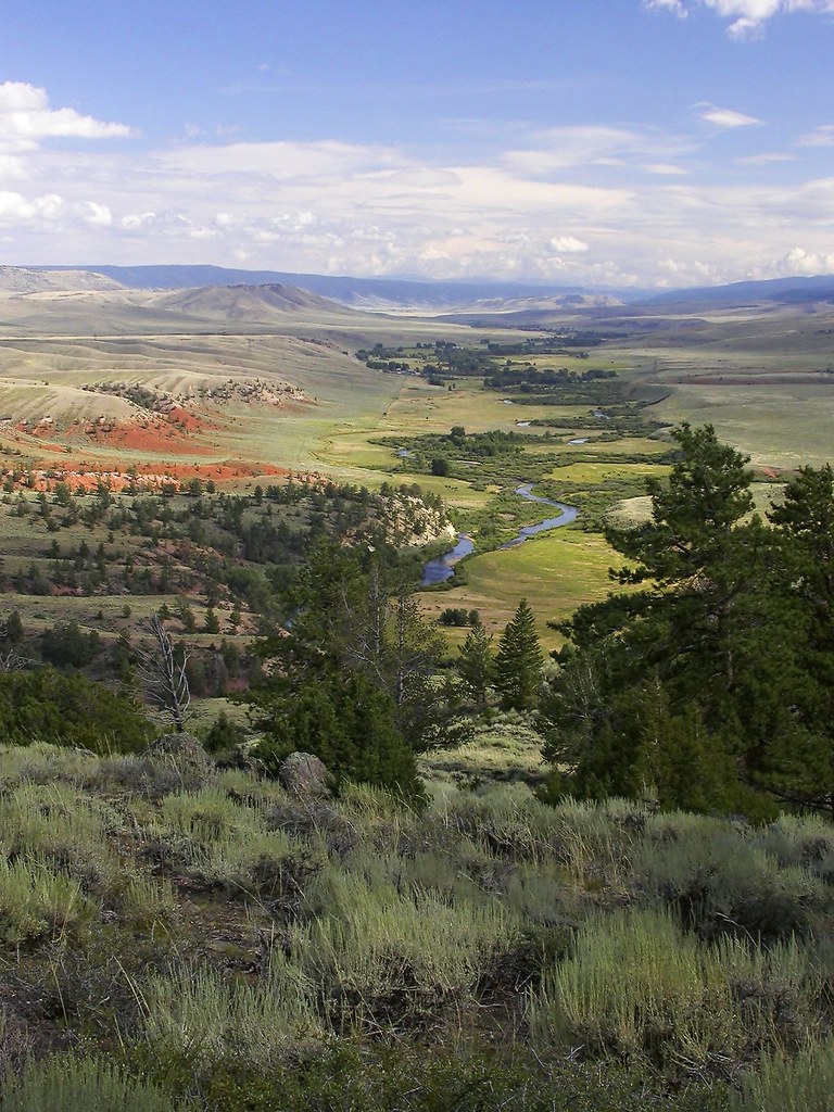
The North Fork of the Poudre River in the Laramie Foothills offers one of the last major unroaded canyons in Colorado. The Nature Conservancy has one of the most striking portions in the Phantom Canyon Preserve and upstream of their property the Colorado Division of Wildlife holds the land in the Turkey Roost section of the canyon. This area really is still a mostly unknown treasure of the Front Range of Colorado, and in my opinion one of the most beautiful landscapes we have. Thankfully, local groups have undertaken one of the most successful large-scale conservation projects in the urban corridor of Colorado, with the entire Laramie Foothills area clear out to the plains looking set to be protected for a long time to come.

This is where we headed for the holiday weekend and once there we saw virtually nobody the entire time, it was a great respite from the busy city daily grind. I barely touched the camera as we mostly sat around lounging playing board games and staring at the gorgeous scenery. But I had to take a few photos to share.

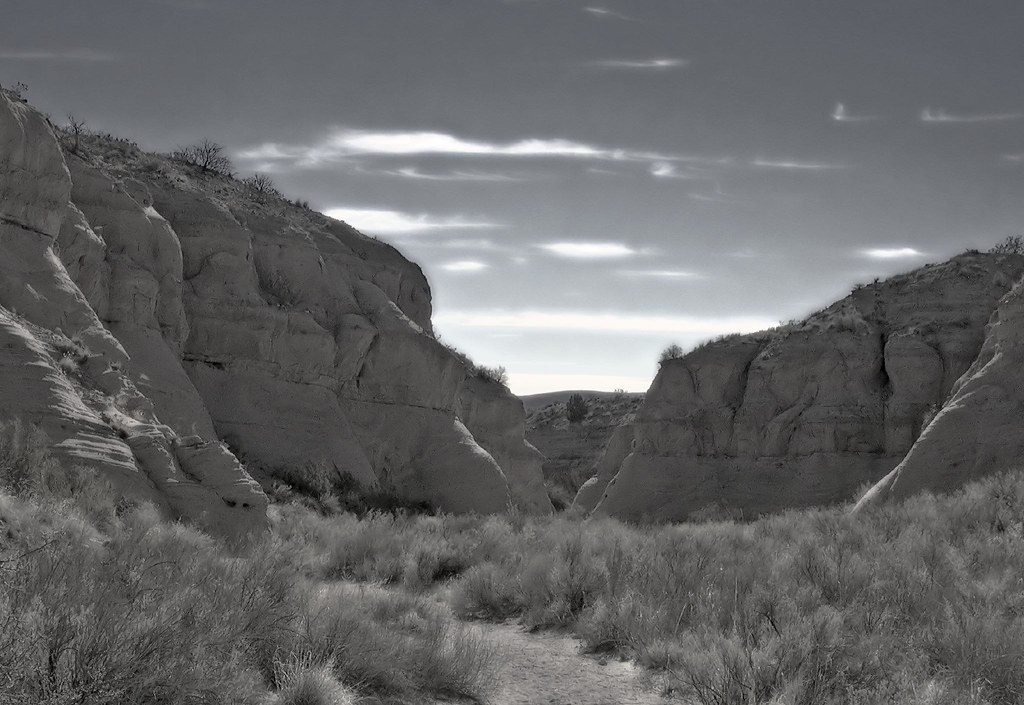
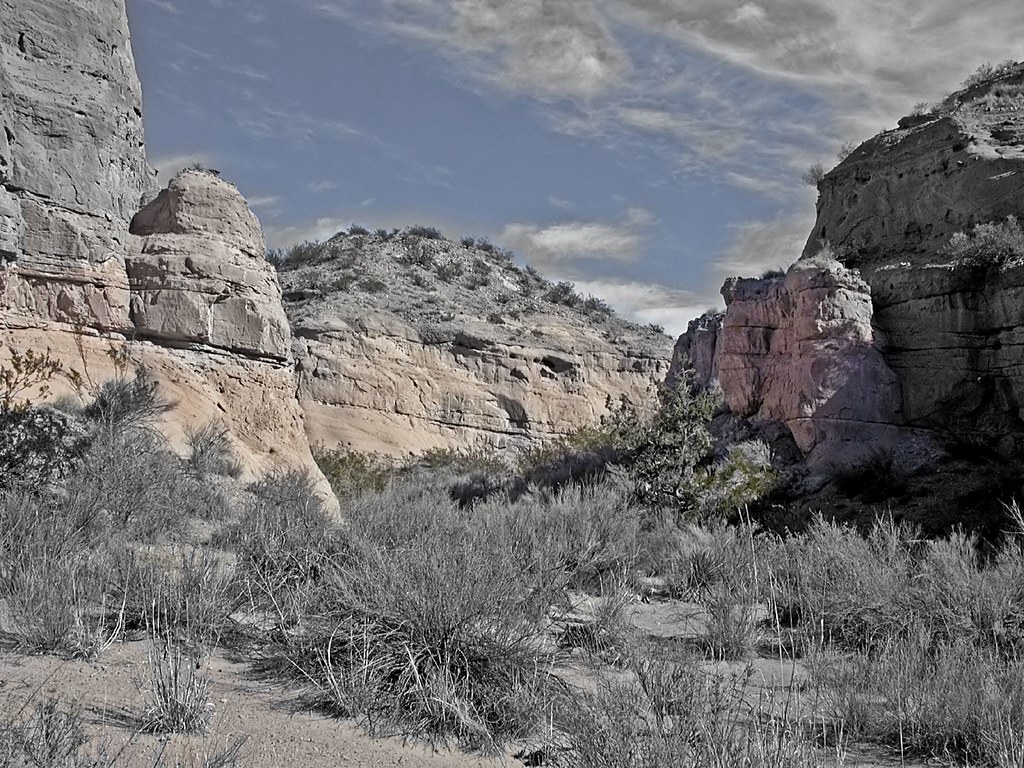
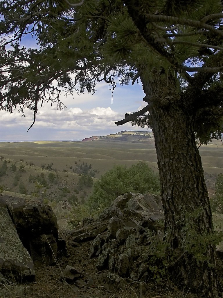
Here's a couple of the Turkey Roost area just as a major thunderstorm was moving in. Lucky for us we were on our way home just as it struck.


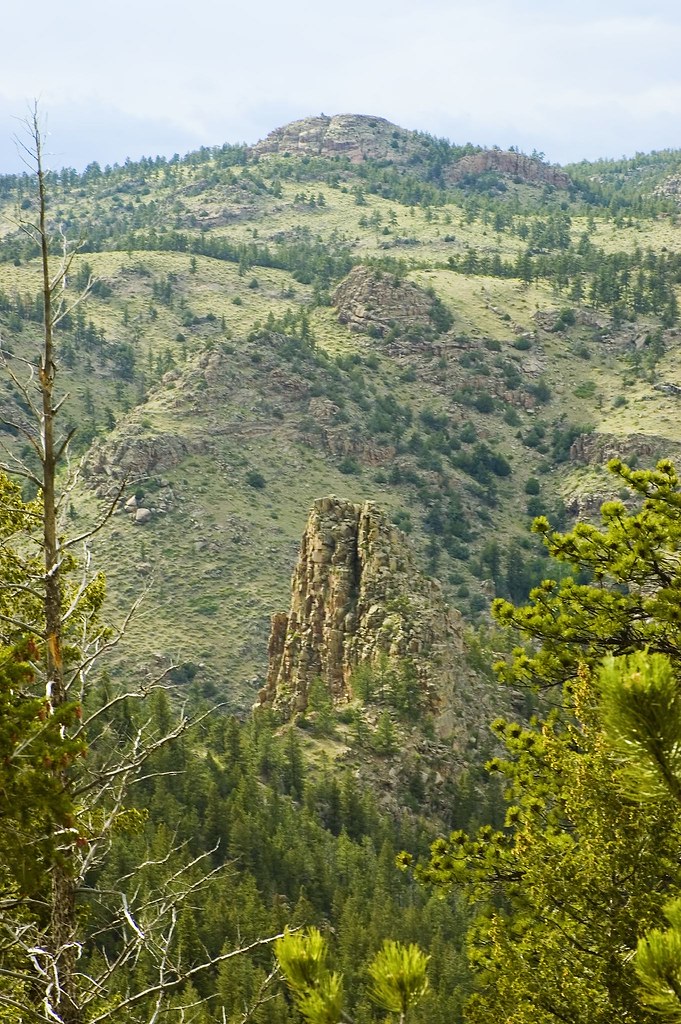
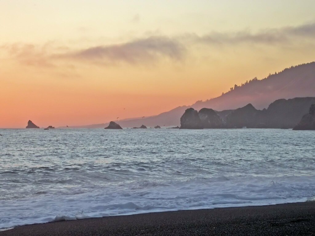
This next photograph features the view from our campsite just north of the area above.


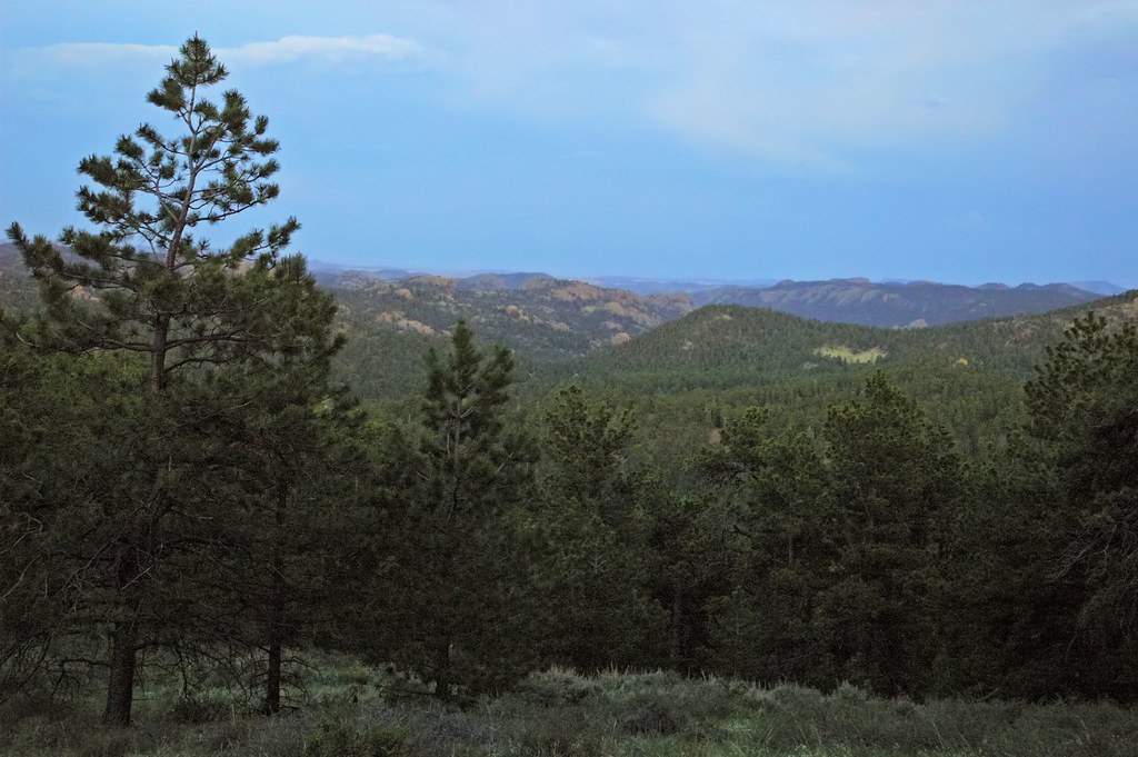
Here's a shot taken at twilight as we walked back to our campsite.


Thursday, May 25, 2006

Desert Mirage

Bosque del Apache National Wildlife Refuge is world famous for its Snow Geese and Sandhill Cranes, but few know of it's extraordinary canyons. When I was looking through some photos I had taken in the area, I realized how these might be well-suited for some experimentation. Here's a view of one of Bosque's canyons done with an artificial infrared effect:


Here color gets thrown into a desert wind...


Thursday, May 18, 2006

And Now For Something Completely Different...

Based on the photographs I've posted here so far it would probably seem safe to assume I am a strictly nature photography kind of guy. However, we all know the dangers of the word assume.


In an effort to prove the maxim true, here is a surreal landscape that began life as a photograph I took of the Lake Michigan shoreline (make sure you click the picture to view a larger version, the small one here is lacking a lot of detail).


And I just can't resist sharing this photograph of my niece from this past Mother's Day weekend.

Friday, May 12, 2006

Pacific Gold

These photos are from a fairly recent trip we took with my wife's family out to Sonoma County, California for a wedding. One night we managed to sneak away to catch this beautiful sunset.


Tuesday, May 09, 2006

Signs of Spring

Thanks to a release on Long Island, N.Y. in 1940 the House Finch is nearly everywhere in the United States. This beautiful bird was once constricted to a much more narrow distribution in the Southwest and Mexico prior to the release.

Tonight after work we had a pair out courting in our backyard, and then the female set about to working on a nest. Finally a chance to take some new pics from my new Nikon D70!

Here you can see the female with a stick in her beak (click the photo for a larger version to get a better view of the tiny stick):


The males get their distinctive red color from pigments in their food during molt. Females tend to prefer the most red males around for mating, perhaps it's an indicator of their ability to find food? Here's the male from tonight:


Thursday, May 04, 2006

The Other Side of Arches

When most people think of Moab, Utah they think of Canyonlands and Arches National Parks with red rock country mountain bikers love to dream about. Mentioning how beautiful the La Sal Mountains are typically yields a blank look.

Perhaps this series of photographs might make you consider taking a closer look at these mountains rising just to the east of Moab. The La Sals formed roughly 24 million years ago and include 6 peaks that rise above 12,000 feet, the tallest being Mount Peale at 12,721 feet. The chain is relatively small at only 15 miles north to south and 6 miles across. Native American occupation started as early as 12,000 B.C. Ecology of the area includes massive amounts of quaking aspen and smaller amounts of fir forests, interspersed with alpine meadows. The entire area is a fall photography wonderland.

For a trip to explore the La Sal's on your way home that will ultimately get you back to I-70, take the La Sal Mountain Loop Road that begins on US 191 six miles south of Moab. It winds north over the La Sal mountains through Castle Valley to end at U-128. Here's a view of the of the La Sal Mountains at sunset from Arches National Park:


And here's a series taken along the La Sal Mountain Loop Road:


Wednesday, May 03, 2006

More Fun with Macro

I think the complexity of this flower is pretty amazing:


Monday, May 01, 2006

The Gem that is the Laramie River

The Laramie River is one of my favorite places to visit in Northern Colorado and Southern Wyoming. There are many different kinds of terrain and habitats as you move down the valley to the town of Laramie from high in the Colorado Rockies. Here's a photograph taken from a favorite vantage point to see a large chunk of the valley in this section:


One neat thing about this overlook is the view is fantastic even looking away from the river: